Date: Fri, 23 Dec 2011 12:04:15 +0100
<http://erigazette.org/?p=735> Eritrean Geophysical Survey Update Posted on
22 December 2011 Tags: Adobha Resources, Eritrea, Gippsland Limited, mining
Read in PDF:
<http://www.gippslandltd.com/upload/docs/111222_ASX_Eritrean_Geophysical_Sur
vey_Update.pdf>
http://www.gippslandltd.com/upload/docs/111222_ASX_Eritrean_Geophysical_Surv
ey_Update.pdf
Dec 23, 2011
http://www.capitaleritrea.com/wp-content/uploads/Gippsland-Eritrea.jpg
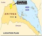
Gippsland Limited ('Gippsland' or 'the Company') [ASX: GIP, FRA: GIX] is
pleased to announce that it has received the final levelled data for the
5,161 line-kilometre airborne geophysical survey over the Adobha and
Gerasi South licence areas in Northern Eritrea held by its wholly owned
subsidiary Adobha Resources (Eritrea) Pty Ltd. The airborne geophysical
survey covered 19 target areas selected on the basis of Thematic
Mapper (TM) anomalies, geological targets, and geochemical anomalies
identified during geochemicalsurveys by Gippsland completed during late
October to early November 2009, May 2010 and July 2011. The survey was flown
by Geotech Airborne Limited using a Versatile Time Domain Electro Magnetic
system (VTEM) at a line spacing of 200m with a nominal height of 80-120m
determined by the topography. Aeromagnetic data was also acquired as part of
the survey.
Interpretation of the data by the Company's consultant geophysicist has
identified 16 electro-magnetic (EM) anomalies which have been ranked on the
basis of their EM response (intensity and decay rate), geological setting,
proximity to TM anomalies and presence of coincident geochemical anomalies.
It is encouraging to note that in the central part of the project area there
is a close association between the VTEM anomalies and regional drainage
geochemical anomalies identified from the geochemical sampling completed
during July 2011. The regional geochemical sampling could not be completed
due to the lack of helicopter availability and will recommence when a
suitable helicopter is available.
Field inspection of the EM anomalies was completed in early October in order
to determine appropriate further exploration with a view to drill testing at
the earliest opportunity. Access to the VTEM anomalies varies considerably
with some easily accessible for drilling whereas some will require light
portable drilling rigs to be flown in by helicopter
Follow-up exploration in the areas of the VTEM anomalies has commenced with
programmes of geological mapping, in-fill drainage sampling, and soil and
rock-chip sampling. Gravity surveys are being planned for the high to
medium priority VTEM anomalie
The Company has submitted an application for an Exploration Licence to cover
the area to the west of the granted Adobha and Gerasi South Exploration
Licences.
Ian Gandel Chairman
For further detail, contact info_at_gippslandltd.com
Suite 4, 207 Stirling Highway Claremont WA
6010 Australia
Phone +61 8 9340 6000
http://www.gippslandltd.com/upload/docs/111222_ASX_Eritrean_Geophysical_Surv
ey_Update.pdf
----[Mailing List for Eritrea Related News ]----
(image/jpeg attachment: image001.jpg)